
Buoys and markers serve to direct the operator of the water vessels on the safe course to take. They warn the operator of the underlying dangers in the waterways. Navigation buoys and markers are also effective navigation aid in directing the water vessel operator on the best route to use.
They aid in determining the safest way through the waters. The functions of the buoys, lights, and marks in navigation serve equivalent to those of traffic lights and road signs for drivers.

In the navigation system, each mark features its color, shape, top mark, alongside the light. Boaters and other watercraft operators should acquaint themselves with the different meanings of each mark. By doing so, they can navigate safely to reach their destinations.
Every boater is therefore advised to carry along a navigation chart. The chart is essential in determining your location. It also serves to familiarize one with the features found in the waterway. The chart features markers, buoys, beacons, and even lighthouses.
It is essential to know that, when heading upstream, red buoys are present and are on the right side. When heading downstream, green buoys are on your left starboard, and they seem reversed.
Navigation Buoys And Markers That We Need To Know
Lateral Marks
Lateral markers are a navigation aid that serves to indicate the extent of safe water. The markers incorporate colors and numbers to pass the information.
There are different types of lateral marks; port, starboard, and even single lateral markers. Both the port and the starboard are best recognized as the lateral marks. The functionality of the different markers differs.
-
Port Hand Markers
Port hand markers feature different shapes. They are represented by red colors and also red lights. At the top, they are designed to have a can-shape. The can shape also known as a buoy. When lit, the left-hand markers display a flashing red glint of light.


-
Starboard Hand Markers
Starboard markers feature a cone-shaped top mark. They are green in color. When lit, they exhibit a green flash of light. They are designed to have varying shapes. However, watercraft operators are advised to sail between the port and the starboard markers if they are in proximity.

-
Single Lateral Marks
It is not often that you find lateral marks in pairs. Therefore, it is upon oneself to decide which side is safe to pass. The safest side through lateral navigation markers depend on; whether traveling towards or away from the sea. When sailing upstream, it denotes that you are sailing away from the sea. When one is sailing downstream, it signifies that one is traveling towards the sea.
Watercraft operators should know that, when traveling upstream, one should keep the red port hand marks on the left side. At this point, the green starboard hand marks should be on the right side. It is different when traveling downstream where the red left-hand marks should stay on the right side. In contrast to when sailing upstream, the green starboard hand mark should stay on the left-hand side on your way downstream.
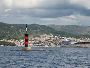
Nuns
They feature a red color. They are cone-shaped and are marked with even numbers. They are lateral navigation aids.
Cans
They are cylindrical shaped. They feature a green color. Cans are marked with odd numbers
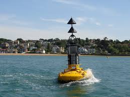
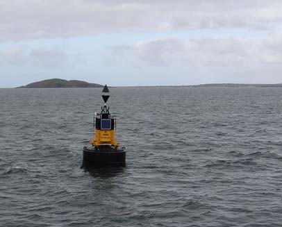
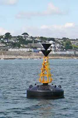
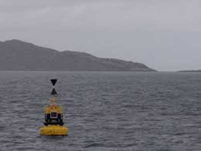
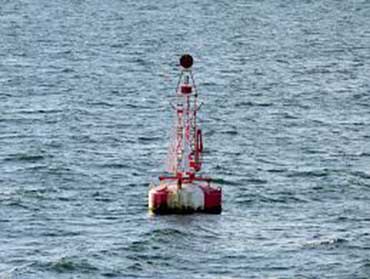
Cardinal Buoys
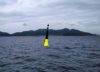
Cardinal buoys serve to give the direction of deeper waters away from water dangers. The dangers may be reefs, shallow areas, or even buoyant water surfaces. The cardinal marks give the compass direction towards the safe water. They appear painted with black and yellow colors. The cardinal buoys indicate the location of danger for each of the four cardinal points. They include;
-
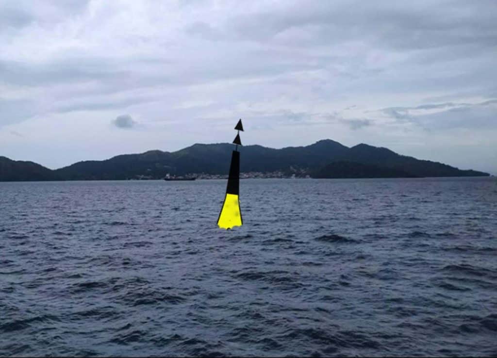
North Cardinal Buoy
Its location indicates that safe waters are in the northern direction. It features a yellow coloration at the bottom and it’s black at the top. The coloring is equal for both black and yellow colors. And, they are above the waterline.

It also features two cones as the top marks. The cones are black, and they lie above each other. The points face upwards. When lit, the buoy features a continuous white flash of light. But, when not lit, it remains spar shaped.
-
East Cardinal Buoy
Its location indicates that safe waters exist on the eastern side of the cardinal. It features a combination of yellow and black colors.

Even so, the yellow band is broad and horizontal and usually in the middle. If it features a top mark, it is two black cones. The cones lie above each other bases. When lit, it displays a white color that flashes in a group of threes. The flashes are rapid.
-
South Cardinal Buoys
Its location indicates that the safe waters exist on the southern side of the buoy. It has an equal color of yellow and black. The coloring is above the waterline.

The upper part of the buoy is yellow whereas the lower part is black. If the buoy features a top mark, they exist as two black cones. The cones lie above each other their points pointing downwards. The buoy features a white light when lit. The light gets exhibited in groups of six which occurs very quickly. After, the lights get followed by a long flash.
-
West Cardinal Buoys
The location of the west cardinal buoys suggests that the deeper waters exist on the western side of that buoy. It features a yellow color which is separated by a broad black band.

Its top mark features two cones that lie above each other. The cones’ points face each other. When lit, the buoy exhibits a white color which flashes in a group of nine. The flashes are rapid. If in any case, the buoy has no light, it is spar-shaped.
Isolated Danger Mark Buoys
The buoy indicates the presence of danger such as rocks and shoals. The waters around the buoy are navigable only when the vessel does not get too close. The buoy is black, featuring one or more horizontal red bands. At the top, they have two black spheres.

When lit, the buoy exhibits white flashes of light in groups of two.
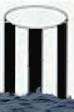
Safe Water Marks
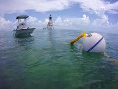
Safe water marks indicate the existence of navigable waters all around the buoy. The buoy has red and white vertical stripes. The top mark features a red sphere.

When lit, the buoy exhibits a white flash of light that lasts for about ten seconds. And, after every ten seconds, the flash is on again.
Special Mark buoys
The buoy serves to indicate the presence of special features. Such a feature may be pipelines or cables. They can also indicate the presence of a channel within a channel.

The way out through such special features is indicated in the boating charts. The buoy features a yellow color, and an X indicates the top mark. When lit at night, the buoy exhibits a yellow flash of light.
Emergency Wreck Marking Buoy
They are useful in indicating new dangers and wreckage. They feature some vertical blue and yellow stripes. The top mark is a yellow cross.

They are designed to have either a spar or a pillar shape. When lit, the flash of blue and yellow light alternates in a span of about one minute. Before another light flash, a moment of about half a second gets marked with darkness.
Non-Lateral Markers (Information And Regulatory)
They inform the watercraft operators about another topic alongside an area of safe waters. Commonly used are the regulatory markers. The markers are white and utilize orange markings and black lettering. They include;
-
Squares (Information)
They deliver information about where to find food, supplies, or even repairs. They also give information about the direction.


-
Restricted Operations Mark
This mark with a circle means that only regulated operations are permitted in this zone.
-
Danger
A white buoy with orange bands at the top and bottom. In the middle with the diamond means danger. Usually, the danger is lettered.
-
Exclusion
A cross inside the diamond signifies that boats can not enter that area.
-
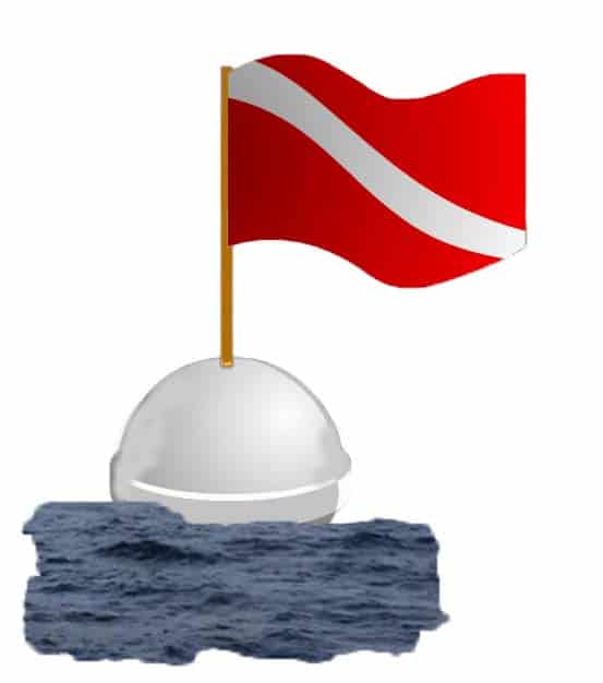
Diving Buoy
It serves to mark an area where activities such as scuba are taking place. The buoy features a white color with a red flag of above fifty centimeters square. The flag has a white diagonal stripe. When lit, the buoy exhibits a yellow flash of light

-
Mooring Buoys
They serve to indicate the anchoring zone. They are white, featuring a blue horizontal band. Mostly, they are found in marinas.
It’s important to know where we can anchor. Also, we must know where we should avoid anchoring.

-
Inland waters Obstruction Markers
White and black vertical stripes are the colors of these buoys. It indicates an obstruction to the navigation. We should not go between these marks and the closest shore.

Intercoastal Waterway Marks (ICW)
These yellow squares and triangles are used to mark other waters. ICW marks are found from New Jersey To the Mexican border. Yellow triangles should be kept on the starboard side (right) of the vessel and the yellow squares should be kept on the port (left) side of the vessel.

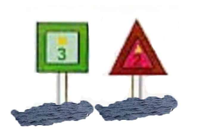
A yellow horizontal band does not provide any lateral information but, marks the ICW.
Leads and Sector Lights
Leads serve to guide water vessels through the waterway. Not only navigation buoys and markers but also the leads are navigation aids through the water. When in the waterway, your vessel should always remain on the safe course.
When it is dark, one should ensure that all the red white, and green lights are vertically aligned with each other. The boaters’ charts and maps have leads. Thus, they are easy to identify.
The chart will help one familiarize himself with the leads before he or she enters an insecure waterway.
Even though, sector light varies from one to the other. When present with a red sector light, one should turn to starboard. If the color is green, one should turn to port.
But, the white color sector light indicates that it is safe to take the course. In some sectors, the lights may mark the entrance to the port. Therefore, it is wise to know that the white sector is the shipping way to the sea.
Blue Middle Channel Mark
These are fixed blue lights. They indicate the middle of a channel. The buoy is useful for a vessel passing below a bridge to maintain its track. However, on boating charts, the blue middle channel marks appear as a star. The star gets symbolized with a flash.
Speed Signs
Speed signs are installed in the waterway to ensure safety. When sailing, the watercraft operator should ensure that he or she travels within a limited speed.
Otherwise, exceeding the speed incurs penalties. Mostly, the speed restrictions are between Four knots and fifteen knots. Every speed determines the kilometers to travel with the speed.
Navigation Through Channels and Rivers
A channel is taken to mean a place whereby it is safe to navigate through. Some channels, though navigable, are not marked. When navigating through channels, it is advisable that one keeps to starboard. Normally, a channel can get too narrow, and thus, it is a must that the sailor keeps to starboard.
However, when sailing along estuaries and rivers, watercraft operators are advised to be super cautious. The reason is that; it is not always that the shallow and navigation hazard zones get marked with the buoys and markers. Even when marked, the shallow area may shift position.
When negotiating bends, extra caution is required. One should look out for oncoming boats to avoid accidents. It is also advisable not to cut corners.
Similarly, in channels and other shallow water stretches, rules and regulations for safety still abide. Forever, it is safe to keep to the starboard which is the right-hand side.
One should be cautious not to impede the passage of large vessels. Water alterations may result to change of the course. Thus, one should be well informed about the channel.
Fishing in channels can obstruct other watercraft from the easy passage. It is therefore right not to go fishing in narrow channels.
Wash
The watercraft operator should ensure that the wash they create does not impact negatively on life in the water or constructions in progress. Different sites get placed with no wash sign. Thus, the vessel operators should ensure that they abide by the rules.
It is wise to be cautious and look behind to see whether your vessel is creating any wash. The excess wash may endanger other vessels and also destroy plants in the water. It is fair enough to adjust to the necessary speed that is wash free.
Conclusion
It is upon all watercraft holders to know their way through the waters. One should get acquainted with every sign and symbol and still know their meaning. By doing so, boating safety is enhanced.
If we find the navigation aids or buoys and markers are not in good condition or not used in the right place, we must inform the nearest US Coast Guard unit.


